In Brief (TL;DR)
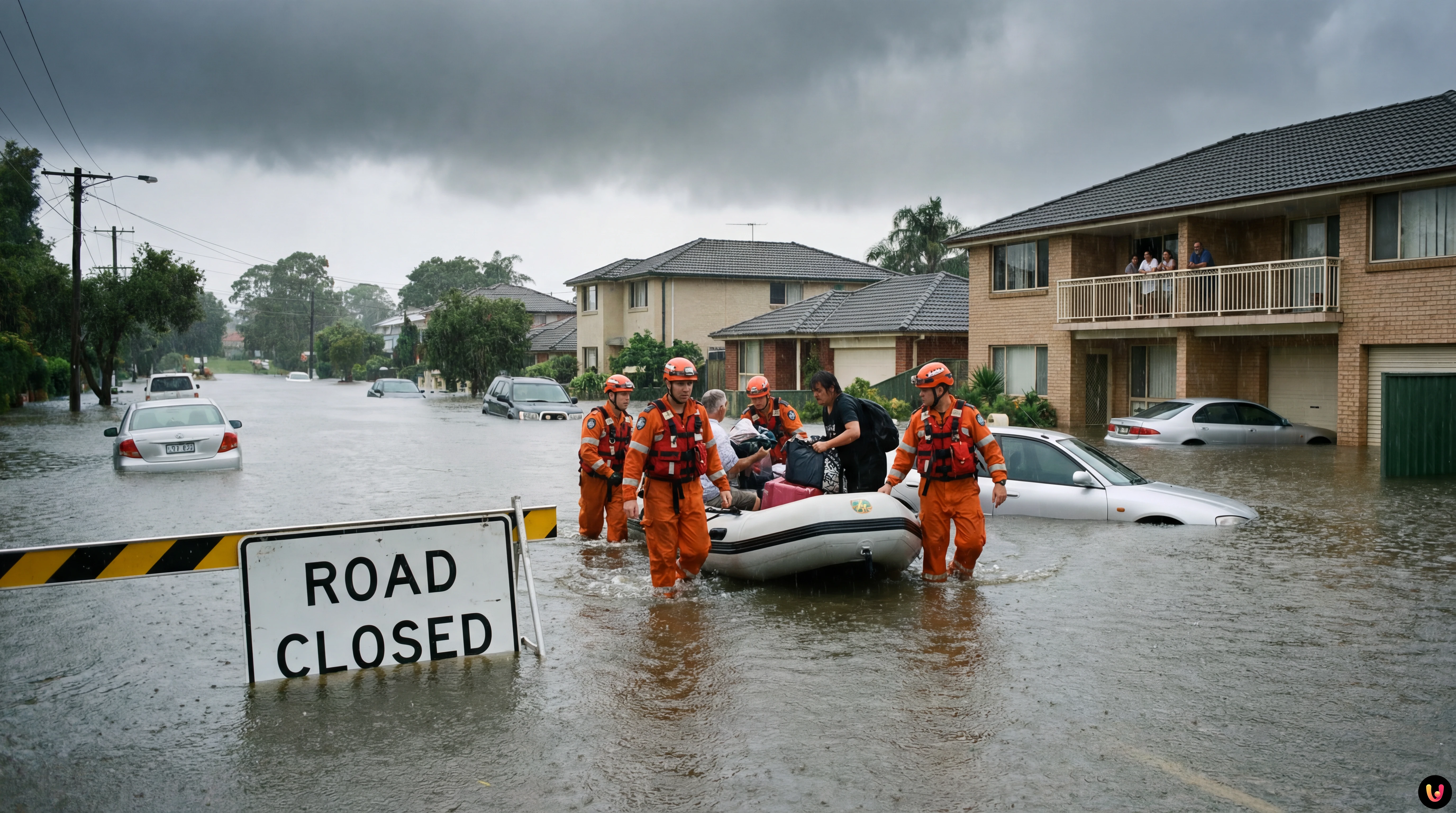
Fatal storms across Sydney and New South Wales have triggered flash flooding and claimed one life amid torrential rainfall.
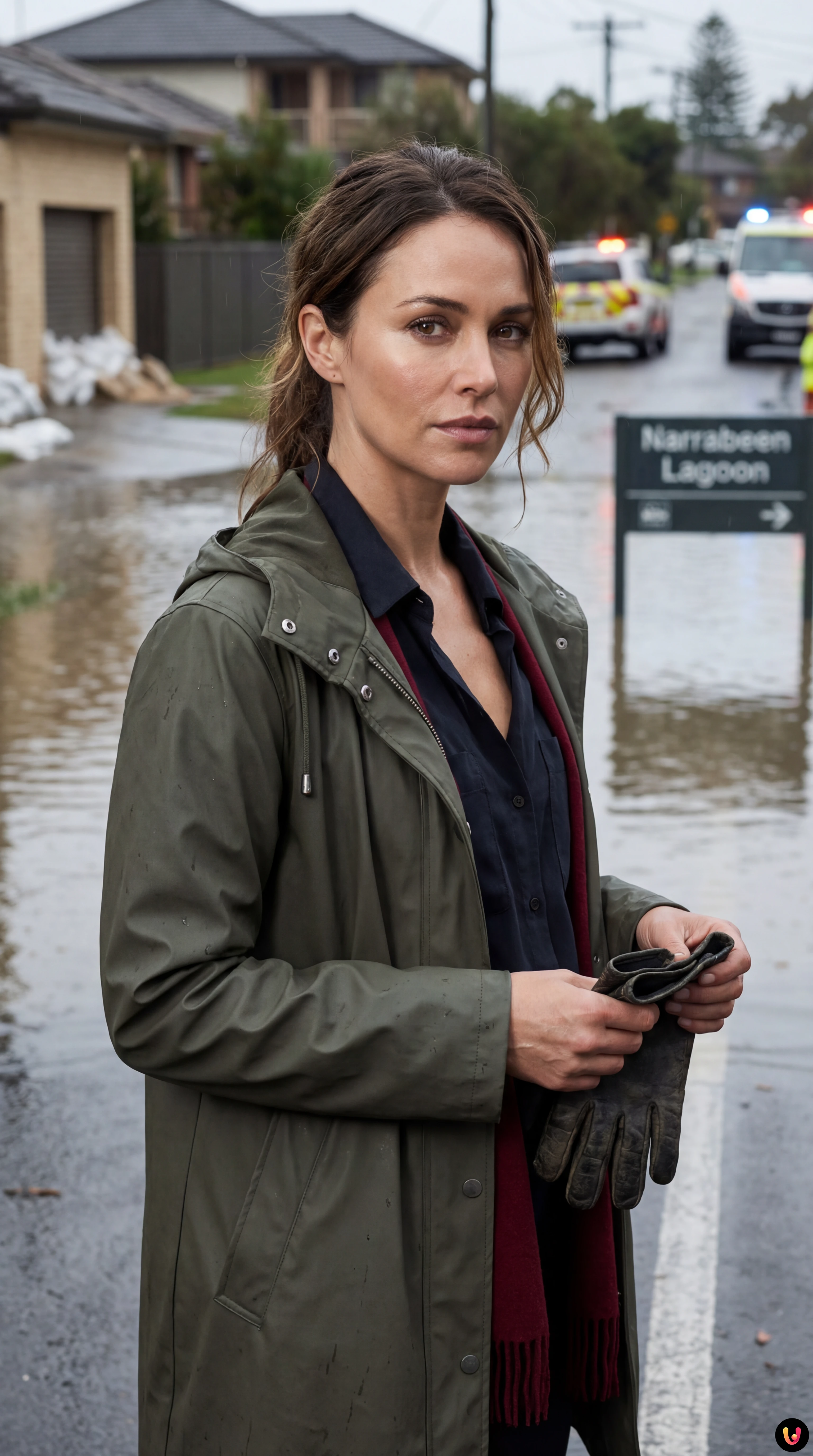
Emergency crews executed dozens of rescues and ordered urgent evacuations in Narrabeen as rising waters threatened residential areas.
Authorities remain on high alert for landslides and hazardous conditions following record-breaking rainfall attributed to warming ocean temperatures.
The devil is in the details. 👇 Keep reading to discover the critical steps and practical tips to avoid mistakes.
Sydney and its surrounding regions are grappling with the aftermath of a ferocious weather system that has unleashed torrential rain, triggered flash flooding, and claimed at least one life. As of Sunday, January 18, 2026, the New South Wales State Emergency Service (SES) remains on high alert following a weekend of chaos that saw suburbs submerged and residents forced to flee their homes in the dead of night.
The severe storms, which battered the coast from the Illawarra to the Hunter region, have dumped up to 200 millimetres of rain in some areas within a 24-hour period. The intensity of the downpour has overwhelmed drainage systems and waterways, leading to dangerous conditions on the roads and significant property damage. According to the Bureau of Meteorology, the deluge was driven by a coastal trough that stalled over the region, creating a conveyor belt of storm activity that pummeled the same areas repeatedly.
While the immediate threat has begun to ease in some districts, authorities warn that the danger is far from over. With ground already saturated and waterways swollen, the risk of further landslides and flash flooding remains high. The tragedy has once again brought the conversation around extreme weather events and global warming to the forefront, as citizens and officials alike reckon with the increasing frequency of such intense storms.

Fatality and Emergency Rescues
The severe weather has had a devastating human cost. According to reports from the Australian Broadcasting Corporation (ABC), a woman lost her life on Saturday when a tree branch fell onto her vehicle at Macquarie Pass, southwest of Wollongong. The incident occurred during the height of the storm, highlighting the perilous conditions faced by motorists. Emergency services were unable to save the driver, marking a somber start to the crisis.
Across the state, emergency responders have been stretched to their limits. The NSW SES reported responding to over 1,400 incidents in the 24 hours leading up to Sunday morning. Among these were 25 critical flood rescues, many involving drivers who had become trapped in floodwaters after attempting to cross inundated roads. NSW SES officials have reiterated their plea for drivers to avoid floodwaters, emphasizing that the majority of rescues were preventable.
Evacuations in Narrabeen and Northern Beaches
The Northern Beaches were among the hardest-hit areas, with the suburb of Narrabeen becoming a focal point of the emergency. On Saturday night, residents near the Narrabeen Lagoon were issued an urgent evacuation order as water levels rose rapidly, threatening to engulf homes and holiday parks. According to The Guardian and local reports, the order affected hundreds of locals and tourists, including those at the Sydney Lakeside Holiday Park, who were directed to higher ground shortly before 11:00 PM.
Although the evacuation order was downgraded to a “Watch and Act” alert by Sunday morning as water levels began to recede, the damage was already done. In the isolated community of Great Mackerel Beach, accessible only by boat, a landslide triggered by the heavy rain damaged three homes. Fortunately, no serious injuries were reported in that specific incident, but the structural instability has left residents anxious about the safety of their properties.
Record-Breaking Rainfall and Climate Context

The volume of rain that fell over the weekend has been described as “tropical” in its intensity. Data from the Bureau of Meteorology indicates that the weather station at Terrey Hills recorded a staggering 179.6 millimetres of rain in the 24 hours to 9:00 AM on Sunday. To put this into perspective, this single day’s rainfall surpassed the total precipitation recorded for the entire month of December in the previous year.
Meteorologists explain that the storm system was fed by moist easterly winds from a warm Tasman Sea, a phenomenon that is becoming increasingly consistent with climate change models. As global warming heats the oceans, the atmosphere can hold more moisture, leading to short-term rainfall events that are more violent and unpredictable. The recurrence of such “one-in-100-year” events suggests a shifting baseline for what constitutes normal weather in the region.
Current Outlook and Warnings
As of Sunday afternoon, the heavy rain has started to contract northwards, but the Bureau of Meteorology has maintained severe thunderstorm warnings for parts of Sydney and Newcastle. While the immediate deluge has paused, the environment remains volatile. Hazardous surf warnings are in place for the entire coast from Newcastle to Batemans Bay, with swimmers and boaters urged to stay out of the water.
Cleanup operations are expected to take several days. Power outages continue to affect thousands of homes, particularly in the Northern Beaches and Central Coast, where falling trees have brought down power lines. The SES has advised residents to remain vigilant and to keep up to date with the latest warnings through the “Hazards Near Me” app, as the situation can change rapidly with little notice.
Conclusion

The flooding in Sydney this January 2026 serves as a stark reminder of the power of nature and the increasing volatility of our climate. With one life lost, dozens rescued, and communities displaced, the focus now shifts to recovery and cleanup. As the waters recede, the questions regarding infrastructure resilience and climate adaptation will undoubtedly resurface. For now, authorities urge all residents to prioritize safety, avoid floodwaters, and look out for their neighbors as the city recovers from this severe storm event.
Frequently Asked Questions

The Northern Beaches were among the hardest hit regions, specifically Narrabeen, where residents near the lagoon faced urgent evacuation orders due to rising water levels. The storm also caused significant issues in the Illawarra and Hunter regions. Additionally, the isolated community of Great Mackerel Beach suffered landslides that damaged residential properties, while the Central Coast experienced widespread power outages caused by falling trees.
The extreme weather was driven by a coastal trough that stalled over the region, creating a continuous conveyor belt of storm activity. This system was fed by moist easterly winds coming off a warm Tasman Sea. Meteorologists note that this phenomenon is consistent with climate change models, where warmer oceans allow the atmosphere to hold more moisture, leading to short-term rainfall events that are tropical in intensity.
The NSW State Emergency Service has strongly advised drivers to avoid entering floodwaters under any circumstances, noting that most critical rescues involved motorists trapped on inundated roads. Residents are urged to stay away from swollen waterways and hazardous surf zones. Authorities also recommend monitoring the Hazards Near Me app for real-time updates, as the risk of landslides and flash flooding remains high even after the rain subsides.
The rainfall volume was record-breaking in several areas. The Bureau of Meteorology reported that the weather station at Terrey Hills recorded 179.6 millimetres of rain within a single 24-hour period ending Sunday morning. To put this in context, that single day of precipitation exceeded the total rainfall recorded for the entire month of December in the previous year, overwhelming local drainage systems.
Yes, the storm resulted in a tragic loss of life. A woman died on Saturday when a tree branch fell onto her vehicle at Macquarie Pass, southwest of Wollongong. This incident occurred during the height of the storm and highlights the extreme dangers posed by such volatile weather conditions. Emergency services were stretched to their limits, responding to over 1,400 incidents across the state.


Did you find this article helpful? Is there another topic you'd like to see me cover?
Write it in the comments below! I take inspiration directly from your suggestions.